Long Island (Fort Tidball) Alaska's Major Sites: Castle Bluff
Photo Scrapbook of Long Island Major Sites: Castle Bluff
(Fort Tidball Coastal Battery, Northeast and Point Head Lookouts, Radar Tower)
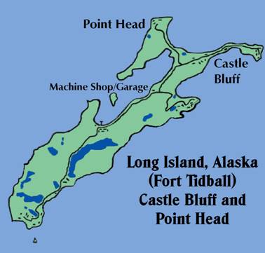
This map derived from Marianne Boko’s detailed wall map which hung in Camp Woody’s dining hall shows the major sites covered in this photo scrapbook.

The author, in 1969, poses through the gun hole of one of the 6 inch coastal battery
cannons on Castle Bluff. I have had a life-
Introduction
This is a scrapbook of photos old and new that cover the major sites on Long Island
from the machine shop area north and northwest, including Castle Bluff and the radar
tower. For scrapbooks on the other major sites of interest on Long Island, Alaska,
and for articles about many visits there, please see the links at the end of this
article. I have shot photos on Long Island since I was a teenager in the mid-
Timothy Smith, web author, spring 2006
Quonsets and Warehouses:
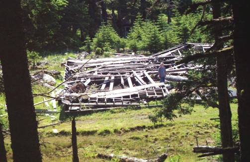
The machine shop building had collapsed by 1996. It has now been completely cleared away. The road to Deer Point branches off from the main road to Castle Bluff at this point. The Castle Bluff road continues past Cook Bay until it terminates at the far northeast cliffs. Along the road are the sagging remains of scores of Quonset huts and warehouses.
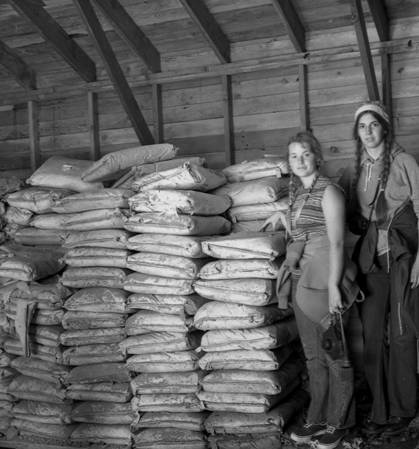
Shelley and Carla examine now-
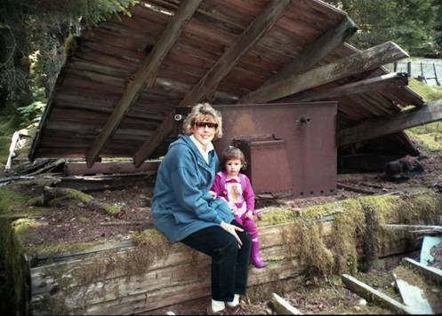
My wife Debbie and little Rachel Adams pose at the remains of the Castle Bluff mess hall in 1996. Most of the wooden buildings collapsed soon after their roofs went bad, or were destroyed by falling trees.
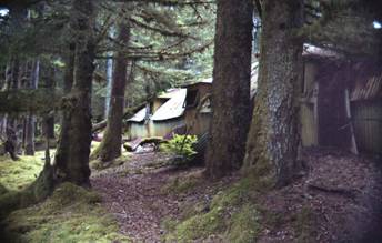
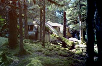
Some Quonset huts still remain, nestled in the trees on the north end of Long Island, as shown in these 1996 photos.
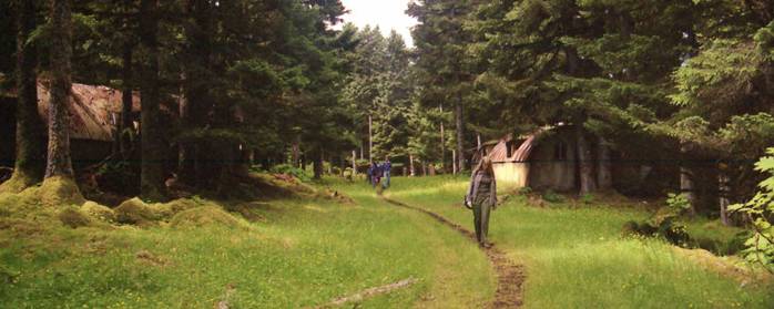
The original gravel roads on Long Island are now grassy paths. The distinct trail was made by cattle that graze on the island. 1996 photo
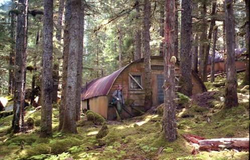
Kirstin Smith poses beside a reasonably intact hut in 1996, with another just up the hill. The largest concentration of Quonset huts on Long Island is in the Castle Bluff area, just before the road branches off to the radar tower.
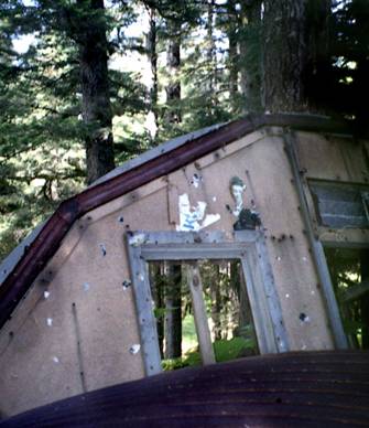
The remains of photos of pinup girls still grace the wall of this collapsed Quonset hut. 1996 photo
WARNING: The next two photos are historic, but explicit!
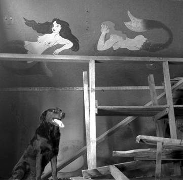
Oscar the Camp Dog poses for me in a peculiar Quonset hut near the radar tower. Warning! The following photo of the same wall is worse!
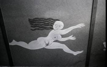
The lonely GIs struck matches in a strategic area of this World War II painting. She was being chased by a devil. Baby Boomers: here’s a look at your fathers’ artwork!
The SCR-
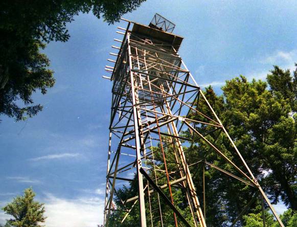
The spectacular radar tower (with its antenna visible on the roof) was still climbable in 1996 when this photo was taken. It has been a challenge to the brave for many years. In 2004 all cross bracing and the ladder had been removed to twenty feet up, making it almost impossible to climb.
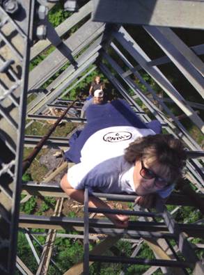
Debbie, Nate and Kirsti climb the tower in 1996.
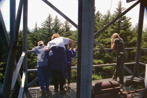
Nate, Debbie, Sarah Adams and Kirsti look down from the tower in 1996. The hatch is to the right, and the steel column in the middle is part of the original elevator shaft (the rusting winch is in the foreground).
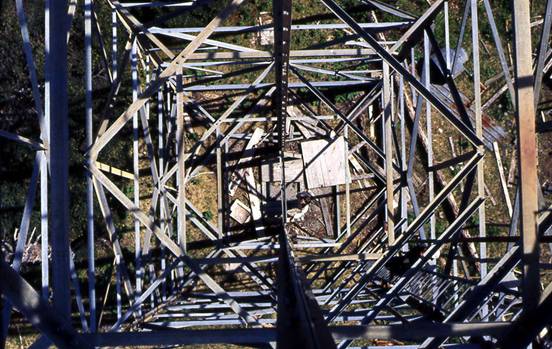
In 1975, Cody Custer braved the gaping hole and shot this photo straight down the elevator shaft!

This telephoto side view from 2004, taken from near the tower’s power shed, shows the elevator hole as well as some other missing floor grates. The antenna is also clearly seen on the roof.
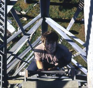
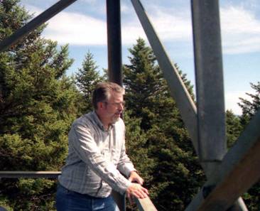
Left: I climb the tower in 1972, as captured by Travis North. Right: I’m looking
off toward Deer Point in this 1996 pose. When I first climbed the tower in the 1960s,
the trees were less than half-
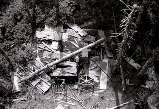
This 1969 view from the tower shows the remains of the collapsed radar equipment building at Castle Bluff. One cabinet, a gray rectangle just below the fallen tree, yielded the following serial plates:
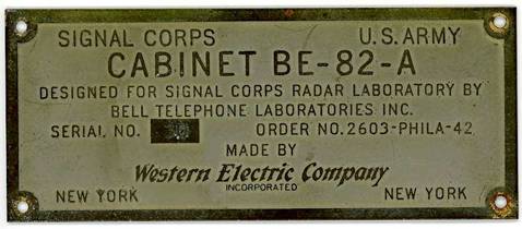
The radar equipment room below the tower, although it had totally collapsed, still yielded a serial plate (found inside a closed cabinet).
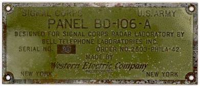
An exterior panel, exposed to the elements, yielded this faded serial plate. The
designation of the radar type was SCR-
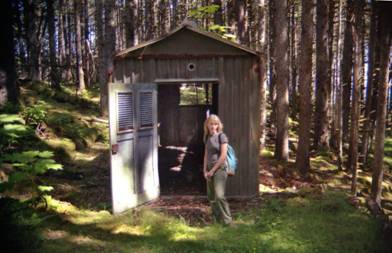
The tower’s powerhouse is in almost new condition because it was made of galvanized panels. The sky beyond is where the coastal battery and bunker lie at the top of Castle Bluff. 1996 photo
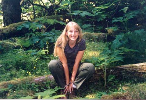
Our daughter Kirsti, about to become a high school freshman at the time, poses just past the radar tower as we hike toward the coastal battery. This is here because I love this photo! 1996 photo
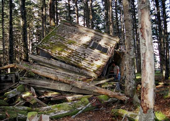
Through the woods past the radar tower, heading north, past the tower’s generator
shed, lies the collapsed single-
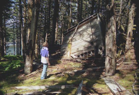
Bruce Adams inspects the fallen tower as seen from the north looking south in this 1996 photo. The northern end of Cook Bay is visible to the left through the trees.
The Coastal Battery at Castle Bluff:
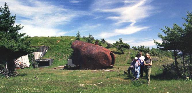
A 1996 photo shows the author’s family standing near the south gun turret of the coastal battery on Castle Bluff. There were originally two 6 inch guns at this site, but they were exploded after the war. This is the view you see when you emerge from the woods a short distance past the collapsed tower.
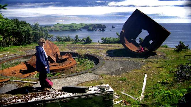
Debbie Smith inspects the more obviously damaged north gun (on the other side of the bunker) on a gorgeous day in 1996. The point beyond has several lookout pillboxes, but all the Quonset huts have collapsed due to direct exposure the elements for over six decades.
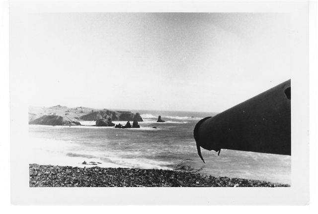
This remarkable photo from George Reynolds via kadiak.org shows the barrel of a working 6 inch coastal battery cannon, seemingly aimed at the northeast point! This photo was taken in 1947 while Mr. Reynolds had the duty of maintaining the guns. There was a large supply of ammunition on the island after the war, and the guns were destroyed once the ammunition was removed. (All info is also on the kadiak.org website)
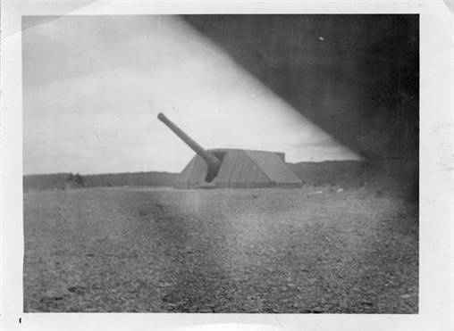
Another remarkable photo from George Reynolds via kadiak.org shows that the guns were once covered with a wooden cowling. This photo is from elsewhere, but the Castle Bluff battery had similar treatment.
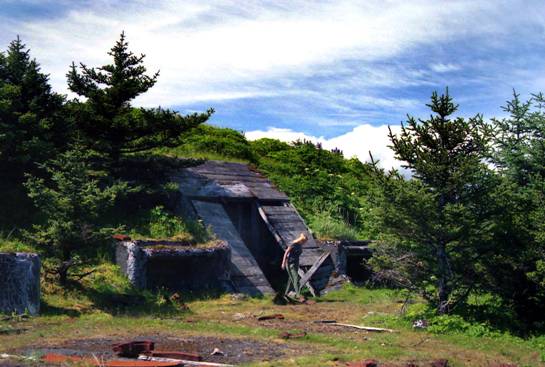
Kirstin Smith emerges from the north entrance to the bunker’s upper hallway in 1996. For the purposes of our photo scrapbook, we will go in that way.
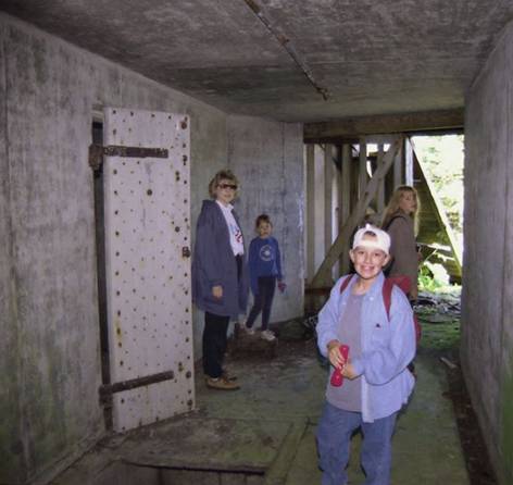
The Smith family and Sarah Adams (in the blue sweatshirt) explore the Castle Bluff bunker upper hallway in 1996. The many doors like the one to the left once held ordnance. Note the gaping hole to the left of my son Nathan. The stairwell to the lower level is behind me and to the left.
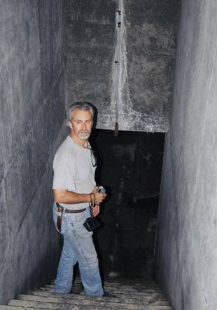
My brother Kelly descends the to the lower level from the upper hallway in pitch darkness in 2004. I must have momentarily blinded him! Not having a flashlight, I navigated the passage using the “red eye” light on my camera.
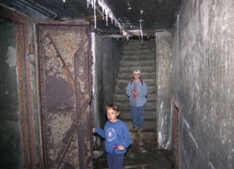
Sarah and Nathan come down the stairs to the lower hallway in 1996. To the left the blast doors lead to a plotting room and the telephone switchboard. To the right (visible through the square hole at deck level) is a large room filled with various debris. Its doorway is behind me and to the right.
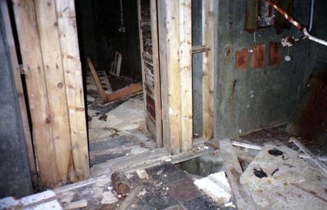
Through the blast doors is the plotter room with its two-

My son Nate examines the telephone switchboard room, with large chunks of the soundproofing all around him. This photo and the one above are from 1996; things had changed little inside from the time when I was a kid in the 1960s until the cleanup. Now the floors and ceilings of most of these rooms are completely bare, and the floor trenches have been filled with concrete.
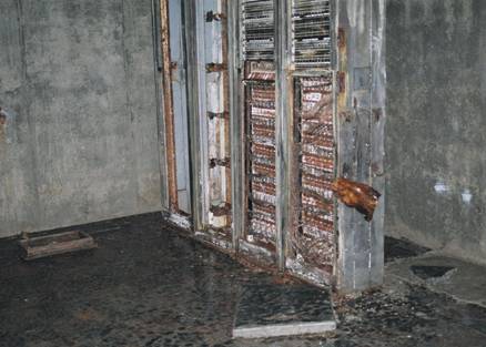
The cleaned switchboard room as it looked in 2004. Note the patch of filled-
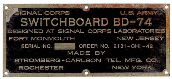
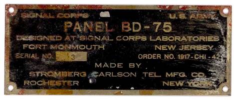
The original serial plates from the telephone switchboard above were scrounged in the late 60s when I brought a screwdriver to the bunker!

The big room on the south side of the ground floor as it looked in 1996 (right side of room looking left).
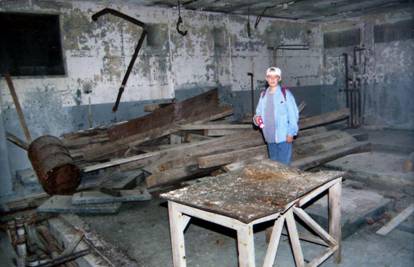
The oil barrel that tipped over and ruined a pair of my pants in 1971 is still tipped over on the left in this photo of the side room in 1996. Nathan, with a flashlight, will avoid such mistakes! Note the open cable and hydraulic line trench on the far left.
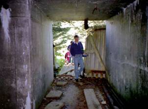
The lower level entrance as it appeared in 1996 (Bruce Adams, foreground). Note the open trench on the right side of the 1996 photo (the covers are on the left side). The same entrance looks different in 2004, after the toxic waste cleanup. The trenches are cemented in, and most of the debris has been removed.
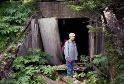
Nate adjusts his eyes as he exits the lover level of the Castle Bluff bunker in 1996. Since then all this debris has been cleared away.
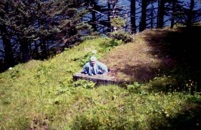
Castle Bluff’s oil depot (now removed) as it looked in 1996. My son Nate climbs out of the buried concrete room, which contained one large fuel tank.
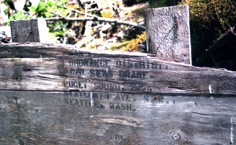
A deteriorating ordnance box could still be read outside the bunker in 1996.

A group of people from the Kodiak Baptist Mission and my brother Kelly (right) explore the Castle Bluff ammo depot in 2004.
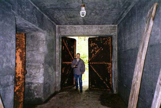
I pose just inside the ammo dump, with one of the chamber doors to my left, in 1996.
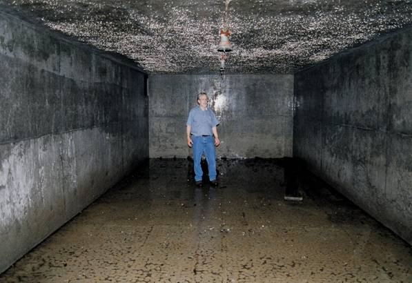
I stand inside the rather moist ammo dump (in one of two chambers) in 2004. The speckles on the ceiling are water droplets, and water is half an inch deep on the floor.
Northeast and Point Head Lookouts:
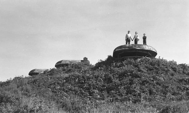
The northwest point of Long Island (called Point Head on the military maps), accessible
from an offshoot of the Castle Bluff road, has many lookout pill boxes, including
this double-
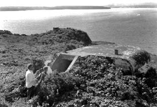
My family explores the double-
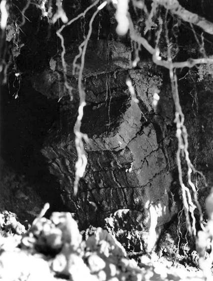
The road to Point Head passes across the northern tip of Cook Bay. There is the
site of an original Russian-
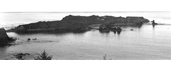
The northeast point of Long Island, the terminus of the Castle Bluff road, as it looked in 1953 when camp first began on the island, with many buildings visible, the road still intact and a huge power line strung between the points. Now nothing remains except the concrete lookouts (visible as several little humps on the crest of the cliff). Soon this point will be a separate island, after the isthmus suffered extreme damage as a result of the subsidence in 1964.
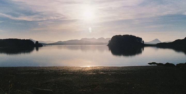
Back where we began: the late evening sunshine reflects off the beach of Cook Bay at the site of the old machine shop in this 2005 photo. Long Island is always beautiful, and will remain so long after all military remnants have disappeared.


To Find Out More About Tanignak.com, Click HERE
To Visit My “About Me” Page, Click HERE
To Return to Tanignak “Home,” Click the Logo Below:
Information from this site can be used for non-


