Long Island (Fort Tidball) Alaska's Major Sites: Central and South
Photo Scrapbook of Long Island Major Sites: Central and South
(Fort Tidball Barracks Area South to Burt Point)
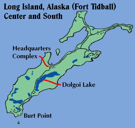
This map derived from Marianne Boko’s detailed wall map which hung in Camp Woody’s dining hall shows the major sites covered in this photo scrapbook. The names and designations are from a military map on the kadiak.org website.
Introduction
This is a scrapbook of photos old and new that cover the major sites on Long Island
from the barracks are at the south end of Cook Bay to the installations on Burt Point
on the southern tip of the island. For scrapbooks on the other major sites of interest
on Long Island, Alaska, and for articles about many visits there, please see the
links at the end of this article. I have shot photos on Long Island since I was
a teenager in the mid-
Timothy Smith, web author, spring 2006
The Main Headquarters Barracks Area:
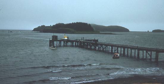
This is the best photo I have of the dock at Long Island as it looked in the 1950s. This
slide was taken in 1956, the summer Camp Woody opened. During the three camping
seasons on the island (1953-
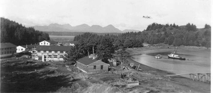
The headquarters barracks take shape in 1943 in this photo from kadiak.org looking west. The tip of the “fox farm” home can be seen above the closest barracks, and beyond are the tips of the tents used by the workers.
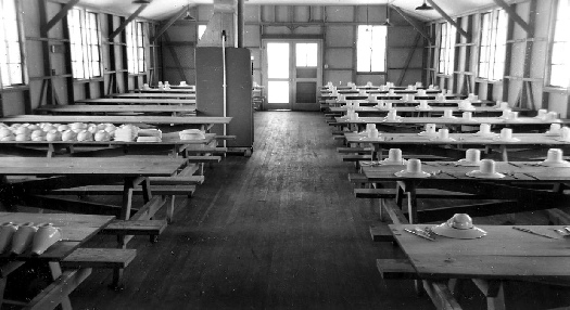
A 1940s photo found on eBay features the interior of a mess hall of almost identical
design to two of the buildings that once stood on Long Island. Photos of the meetings
and activities inside at Long Island camp in the early 1950s show similar windows
and doors. Bench-
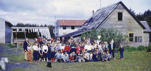
Before Camp Woody opened in 1956, camps were held for the three previous years on
Long Island, at the site of the main headquarters. In 1955, the final year at Long
Island, the last camp posed in the main barracks area. The mess hall is out of sight
to the left. The little kid with the red jacket in the back row (in front of the
deteriorating shed) is the author. This old village-
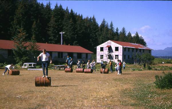
In my article about the beginnings of camping in the Kodiak area, I mentioned that before the Tidal Wave swept them all away, kids would use the many abandoned oil barrels for races. Mab Boko’s photo from 1963 nicely confirms this for me. The brushy area behind the barrels is where the old “fox farm” house stood as late as 1955.
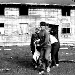
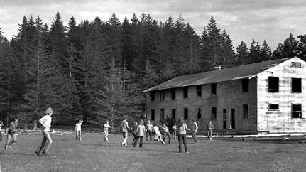
Left: In the summer of 1969, a Red Cross-
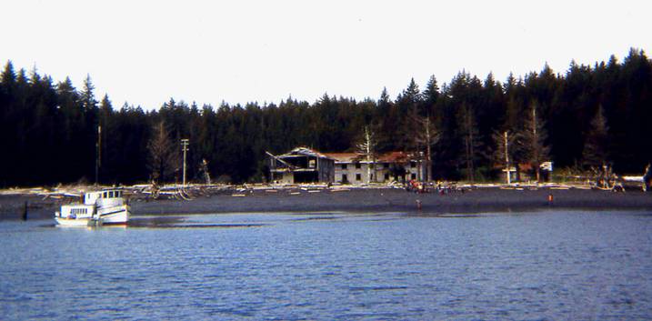
The Evangel anchors at the south end of Cook Bay in this photo from 1975. By then most of the buildings by the bay had been dismantled or vandalized. Debbie Sullens photo
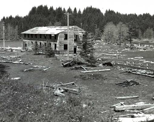
The barracks area as it looked in the mid-

The barracks area is now a meadow with occasional concrete foundations here and there. The foundation in the foreground of this composite photo from 2005 is of the old mess hall. The concrete slab was used by the camp (1953 to 1955) as a badminton court.
Heading South: Dolgoi Lake and the Ammunition Bunkers
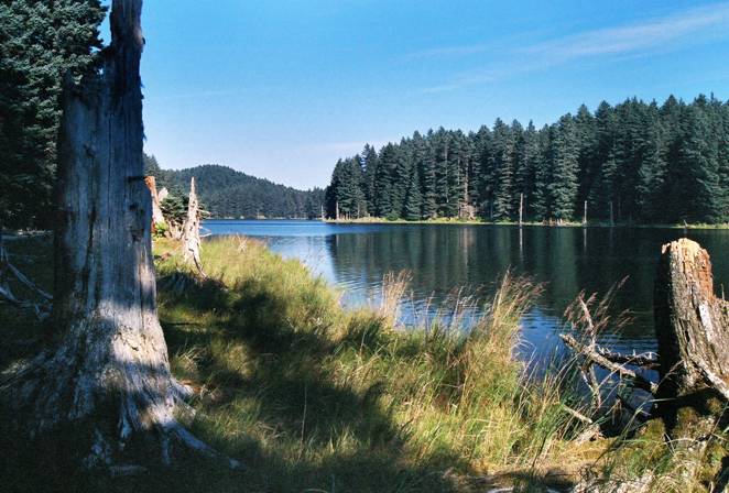
Beautiful Dolgoi Lake, looking northeast (2005)
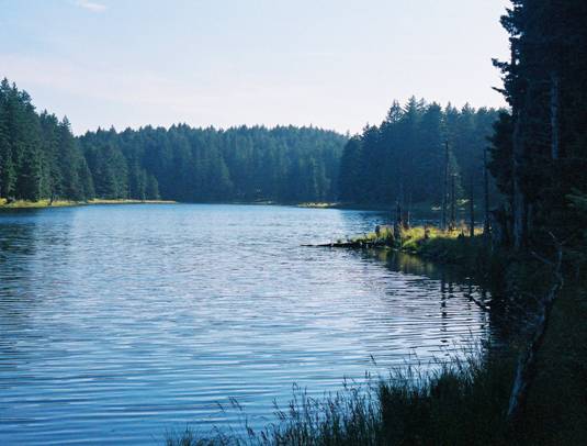
Dolgoi Lake looking southeast (2005)
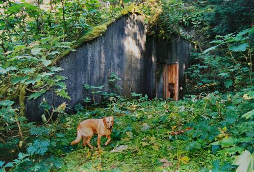
The famous “singing bunker”, the first one at the south end of Dolgoi Lake that Camp Woody campers always used for recording, as it looked in 2005 (with Heather and Emil’s dog). This bunker is much more overgrown, and was almost invisible from the old road. But it still sounds great, with incredible reverb!
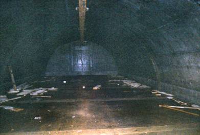
A look inside the second bunker south of Dolgoi Lake in 2005. The debris has remained undisturbed for six decades. These bunkers push the limits of my camera’s flash.
South of the Lake: Cabins, Ponds and Razor Wire
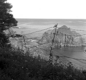
South end razor wire, 1976.
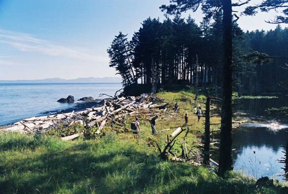
The road suddenly curves out toward the coastline, and the place where I was standing to take this picture is where the gate of razor wire once stood. In the clump of trees beyond the logs is the remains of a log cabin. 2005 photo, with Heather and Emil Norton’s dog swimming happily in the pond at the edge of the photo.
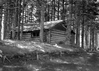
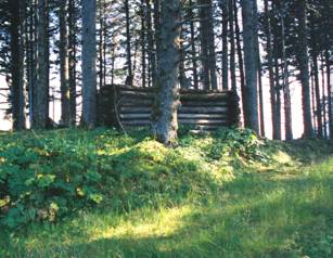
A cute little log cabin right where the road to Burt Point meets the beach, as it looked in 1976 and in 2005. The wall facing the road is the only one still partially intact now.
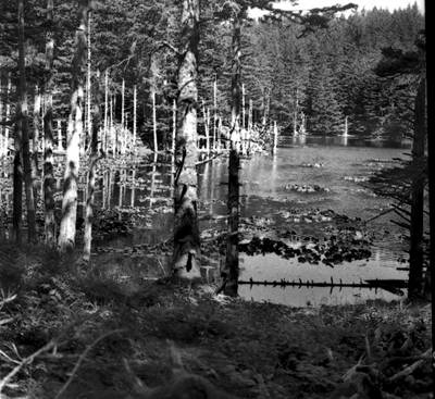
This pretty pond is right across the road from the log cabin. There are several little ponds like this one south of Dolgoi Lake. 1976 photo
The Burt Point Lookout and Searchlight Bunker Area:
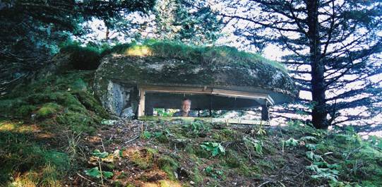
In one of the Burt Point lookouts, the author peeks out the window. All the trees have grown up since the lookout was built. 2005 photo
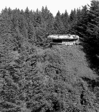
The southernmost lookout on Long Island as it appeared in 1976
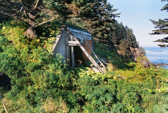
The other purpose of Burt Point was to provide searchlight stations for ships or aircraft that might be spotted. They also had two large machine guns each. Here is one of the searchlight bunkers, with one of its rusting doors still attached. 2005 photo
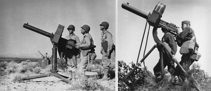
These two photos from the kadiak.org site show two setups for the .50 caliber, water-
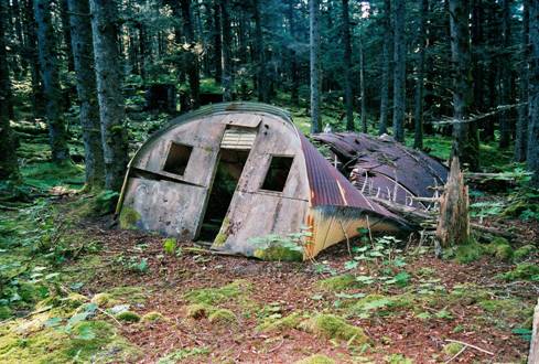
Time has not been kind to most of the Quonset huts on Long Island. This photo from Burt Point in 2005 is typical of what falling trees have done to many buildings across the island.
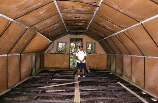
Some Quonset huts still remain standing, and in reasonably good shape after over 60 years of neglect. This one, with Emil Norton, Jr. standing on its floor joists, had its floor panels removed years ago. Even in the 1970s, only a very few of the most remote huts still had their flooring intact. 2005 photo
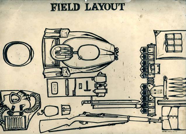
This is a portion of a large diagram, printed on thick glossy photographic paper, that I retrieved from one of the Quonset huts in a little valley near the Burt Point area in 1976. There were also various scraps of magazine photos (usually pinup girls) that could occasionally be found in the huts.
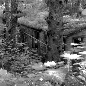
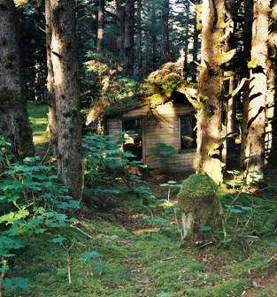
The Burt Point washhouse and shower building as it looked in 1976 and in 2005.
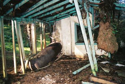
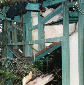
The interior of the shower building shows a hot water tank and even has nail hooks where the soldiers hung their clothes. 2005 photos
The “Secret” Inland Guard Shack and a Western Lake:

This hidden guard shack is well inland, and seemed to be a sentry post guarding a valley. It never had a view of the ocean. Carbine racks are against the wall opposite the door (the photo on the right is of the far side of the guard shack). 1976 photos
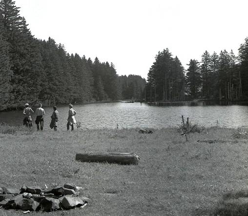
This pretty lake, on the southwest edge of Long Island, was once the water supply for the Burt Point installations. A beach that faces Woody Island is at my back. Someone has made a nice fire circle. 1976 photo.
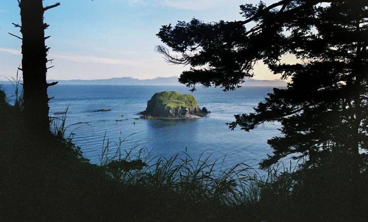
The south end of Long Island abounds in natural beauty (2005 photo)
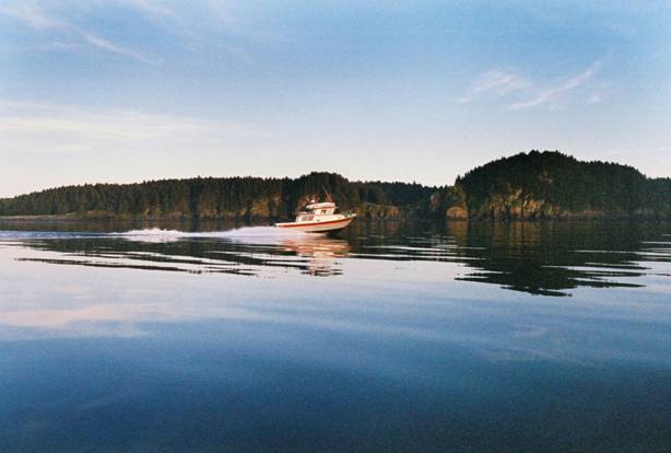
The Nortons’ boat Veritas speeds past the southern cliffs of Long Island on its way
to Kodiak on a glassy-


To Find Out More About Tanignak.com, Click HERE
To Visit My “About Me” Page, Click HERE
To Return to Tanignak “Home,” Click the Logo Below:
Information from this site can be used for non-

