Long Island (Fort Tidball) Alaska's Major Sites: Deer Point
Photo Scrapbook of Long Island Major Sites: Deer Point
(Fort Tidball 155mm Coastal Battery, Second Radar Site, Command Center)
Introduction
This is a scrapbook of photos old and new that cover the major sites on Long Island
from the machine shop eastward to Deer Point, including the command center. For
scrapbooks on the other major sites of interest on Long Island, Alaska, and for articles
about many visits there, please see the links at the end of this article. I have
shot photos on Long Island since I was a teenager in the mid-
Timothy Smith, web author, spring 2006
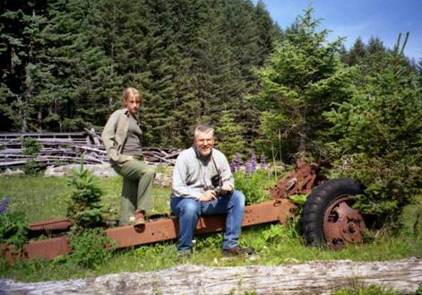
The author and his daughter Kirstin pose on the remains of an Army truck with the collapsed machine shop/garage behind them in the summer of 1996. To the right is the road which goes to Deer Point, and to the left, the road goes to Castle Bluff.

This map derived from Marianne Boko’s detailed wall map which hung in Camp Woody’s dining hall shows the major sites covered in this photo scrapbook. The names and designations are from a military map on the kadiak.org website.
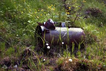
Why the toxic waste clean-

Near the road that goes up to Deer Point, some razor wire slowly rusts in this 1996 photo.
Deer Point Ammunition Bunker:
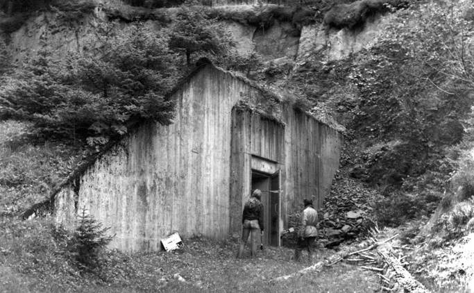
The Deer Point ammunition bunker (in 1974)
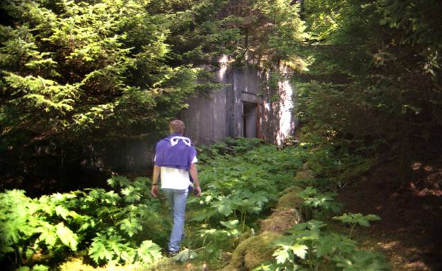
The same bunker is now almost completely hidden by trees and undergrowth. Bruce Adams explores the bunker in 1996.
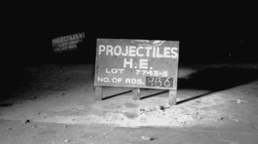
Two signs indicating the types of ammunition that were stored in the Deer Point bunker, as they looked in 1969. The signs have since disappeared.
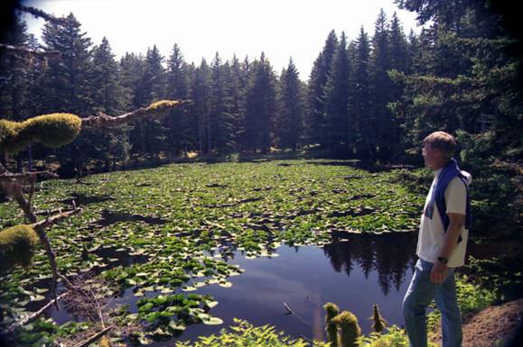
There is a beautiful lily pond just beside the Deer Point bunker. Bruce Adams poses for me in 1996.
Deer Point Spotting and Plotting Bunker:
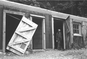
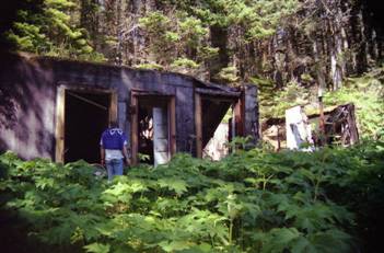
Behind the ammunition dump, and well-
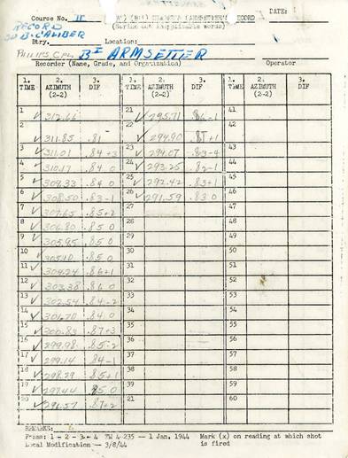
Here is a scan of one of the documents that I salvaged from the collapsing spotting and plotting bunker.
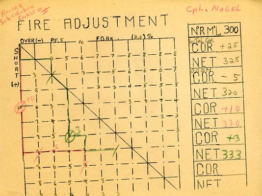
Another of the documents shows corrections for firing the guns on Castle Bluff or Deer Point, found in the “spotting and plotting” bunker.
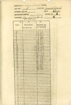
A third sample of the documents found in the plotter and spotter bunker was mimeographed
on legal-
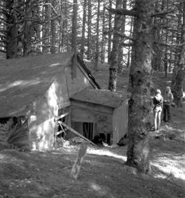

This mysterious half-
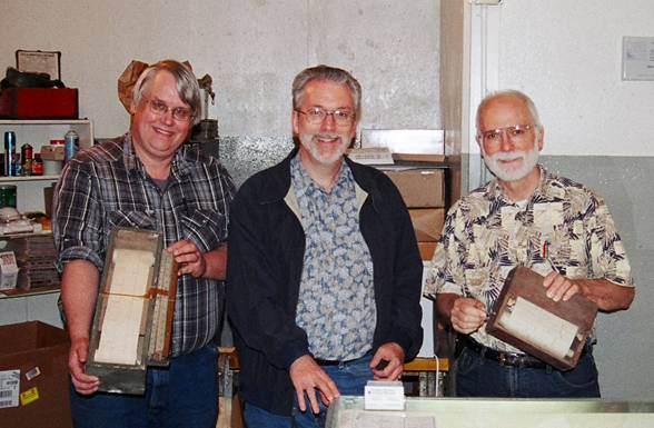
Mr. Law and Mr. Stevens (on either side of me) accept my gift of the World War II artillery plotters that I found in the attic of a building near the Deer Point radar station. (2004 photo, in the Fort Abercrombie Military History Museum)
Deer Point SCR-
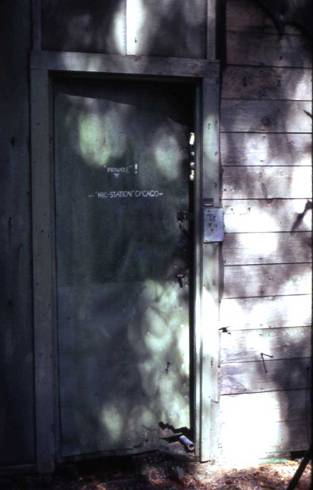
The Deer Point radar station door as it looked in 1972, with its strange painted message, “Private! NBC Chicago.”

The Deer Point radar hut as it looked in 1996, with Bruce Adams looking in.
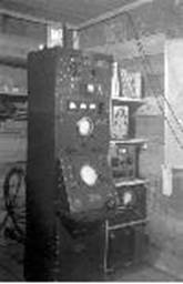
The original console configuration of the SCR-
Deer Point 155mm Coastal Battery:
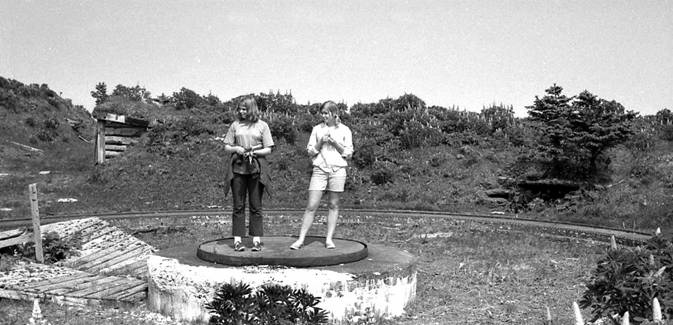
Kathy and Mary pose on one of the four 155mm gun circles in 1969. The guns were
installed quickly, because the equipment was lighter and the setup was much less
elaborate than for Castle Bluff’s 8-

Two of the four 155mm gun circles are clearly visible in this 1996 photo. The little air vent to the left is for an ammunition locker.
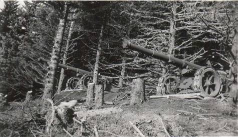
This photo (courtesy of kadiak.org) shows the temporary setup of two 155mm cannons
on Long Island, obviously on wheels. Once the gun circles were built, the guns could
be Panama-
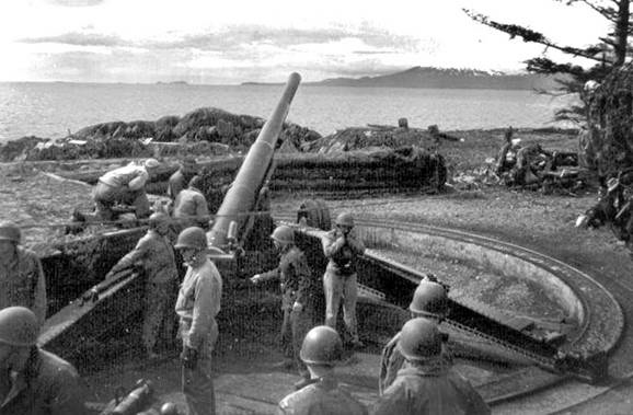
This photo (Masterson collection, courtesy of kadiak.org) shows a 155mm cannon set
up on a “Panama-
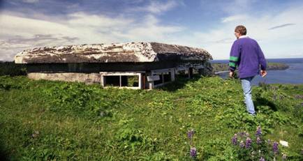
The spotter bunker overlooks the 155mm gun rings out on the cliff. Bruce Adams investigates it in 1996.
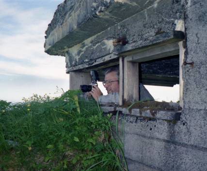
Timothy Smith (the author) peers from the Deer Point spotter bunker in 1996.
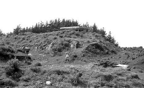
A wide view of the spotter bunker, taken in 1969, shows the entrance (to the lower
left) of a wooden tunnel which may have connected the four 155mm “Panama-
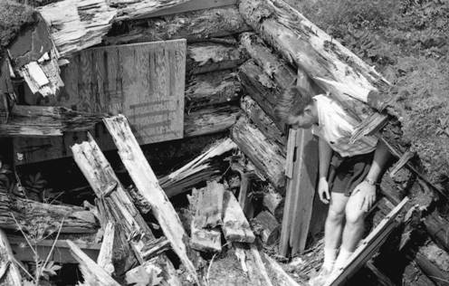
A 1969 photo shows a half-
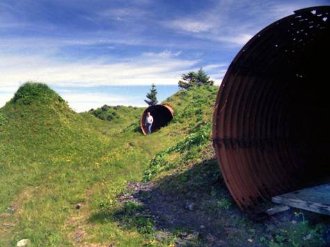
The author emerges out of one of the steel ammunition lockers at the top of Deer Point. Beyond and to the right are the gun rings. 1996 photo
Some Deer Point Service Buildings:
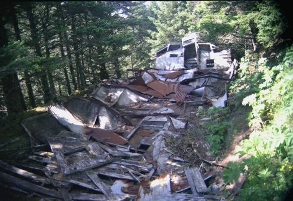
A 1996 photo shows the remains of a Deer Point Quonset hut (just around the corner from the antiaircraft gun circles), which imploded after years of being exposed to the elements. Many of the more sheltered huts are still standing.
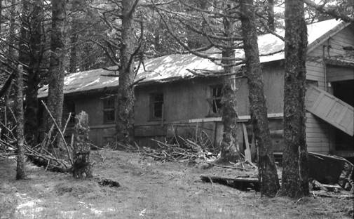
The Deer Point recreation hall (which has since fallen off its foundation) was reasonably well preserved in 1969.
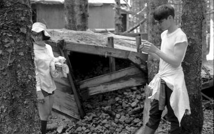
1969: the coal bin near the recreation hall (with Cathy Norton and Karl Childs)
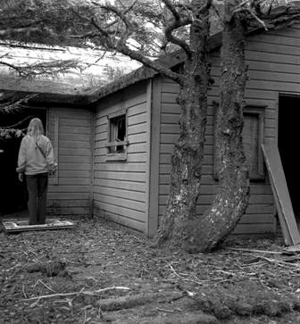
The Deer Point mess hall (in 1973) is across the road from the recreation hall.
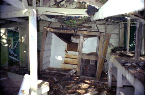
The Deer Point mess hall interior shows the refrigerator in the kitchen in 2004.
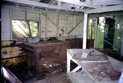
This photo, taken to the right of the previous one, shows the two kitchen stoves and the counters.
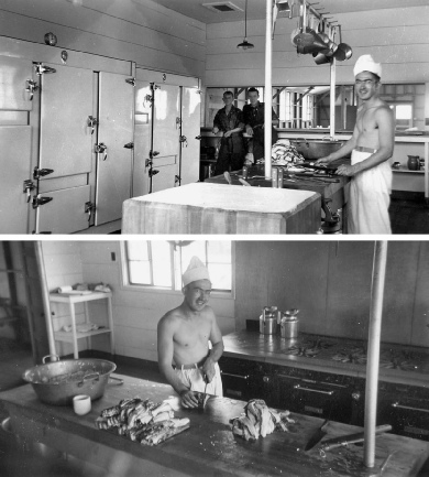
A pair of 1940s photo from a California Army Base shows a similar kitchen in operation. These photos help give a sense that Fort Tidball was once a busy, populated place. (Photos found on eBay; photographer and subject unknown)

Lupine blooms on Deer Point in the summer of 1996, while a pleasure boat cruises in Chiniak Bay. The remnants of war will eventually fade away, but the natural beauty of the island will always make it a spectacular place to visit.


To Find Out More About Tanignak.com, Click HERE
To Visit My “About Me” Page, Click HERE
To Return to Tanignak “Home,” Click the Logo Below:
Information from this site can be used for non-


